Transit

Step up to the platform. The city is already moving.
Hamilton in 2092 does not ask you to drive. It asks you to arrive. The MELA is a network that runs on bioelectric pulse and community trust, stitched through the basin like a living circulatory system, free at the point of boarding, quiet enough that you hear the harbour gulls above the hum. What follows is a walking tour of how a city decided that moving people, water, and energy was a commons rather than a commodity, and how that decision reshaped every corridor from the escarpment down to the bay.
Don’t forget · How to read this project

Touch the interface. Wait 2–5 minutes. Board. Ride. Step off. No fares. No tickets. No schedule to memorize.
2.1 Getting Around: A First Orientation
Here is what a MELA (Magnetic Elevated Loop Array, Hamilton's bioelectric transit grid) trip looks like in practice. You walk up to any station, there are more than two hundred across the city, most within a ten-minute walk of where you are. You touch the interface and indicate your destination. Within two to five minutes, a pod arrives. The doors open. You step in. You sit. You ride. When the pod reaches your stop, the doors open and you step out. There is no fare, no ticket, no turnstile, no schedule to memorize.
That is the whole procedure. Everything else in this chapter (the three primary systems, the philosophy of shared movement, the integration with ecological corridors) exists in service of that simple act of boarding and arriving.
The first thing I notice, every time, is the silence. Not absence of sound, the station has its own texture: the soft percussion of other passengers, a child asking something, wind moving through the guideway corridor. But the pod itself arrives without announcement. No diesel exhaust, no brake squeal, no mechanical protest. Just a pressure shift in the air, a faint hum I feel more in my chest than my ears, and then it is there. The doors open on their own. The threshold is smooth, no gap, no step, no hesitation point. I walk in the way you walk into a room you already know. The seat fabric is slightly warm from the last rider. The air smells faintly of the lichen on the rails, mineral, cool, alive. Before I have finished settling, the interface registers where I need to go. The pod already knows. It always does.
This chapter covers the three primary transit systems of Hamilton 2092: the MELA network for getting around the city, the Coast Rail for regional travel, and the Orenda Network that moves energy and goods underground.
The philosophy behind it: Transit here operates as a commons. When you board a MELA pod or a Coast Rail train, you are sharing a space owned and run by the people of Hamilton. Three principles hold the system together: universal access (anyone can go anywhere, free), ecological integration (the network works with the landscape, not over it), and social encounter (shared rides and station spaces are designed to build community, not just save time).


Levels integrating regional rail, MELA transit, civic space, and the Orenda Fountain. Elevated 15–20 m above Lake Ontario’s maximum recorded level.
Lake Ontario wind-driven seiches oscillate on a 5-hour period. Hamilton sits at the vulnerable western end where surge piles up. Compound events generate multi-metre surges.[2]
2.2 Sector NM as Transit Hub

The move to Sector NM was driven by climate data, not preference. The 2041 First Flood and the 2053 post-tropical cyclone showed that waterfront infrastructure, however iconic, is no longer safe ground for critical transit infrastructure. Sector NM sits 15–20 metres above Lake Ontario’s worst recorded surge levels. The primary hub moved here for the same reason you build a lighthouse on a hill.
The migration itself was forced by Hurricane Mera in 2053. The move was not about building something new. It was the opposite: reuse the existing elevated terrain of the escarpment shoulder, avoid laying new streets, keep the rebuild low-cost. The terrain was already there. The streets were already there. The escarpment’s natural grade became the hub’s natural anchor. That is why the MELA coast-rail runs from high ground in Sector NM today, not from the flood-vulnerable harbour edge.
People forget that the Heavy MELA guideway from Waterfront to Confederation runs on the old GO corridor. The same right-of-way. The same alignment through the harbour district. We did not build a new city on top of the old one. We threaded the new system through the bones of the old one. The GO tracks are still down there, under the guideway supports. Sometimes, during maintenance, I see them, rusted Bessemer steel from the 1960s, still holding the weight of the future. That is Hamilton. We do not erase. We build on top.
Mera’s second demand was vertical. The old idea of a single-plane station could not absorb the regional rail, the civic concourse, and a new high-altitude maglev line on one footprint. The hub was therefore designed as a multilevel structure, stacking functions that would have sprawled sideways in a pre-Transition rebuild. That vertical stacking is what lets the high-altitude maglev MELA operate above grade: the upper tiers carry the elevated maglev tracks while conventional surface transit runs below, and civic space threads between them. Without the multilevel design, the maglev could not enter the hub at all.
The escarpment itself did not come through untouched. Along the Sector NM spine, the MELA does not simply ride the escarpment shoulder; parts of the ridge were fast-tracked and partly carved to open a dedicated maglev channel where the grade or curvature refused the line. The rebuild leaned on geology because laying new right-of-way was more expensive than editing the one that was already there. Afterwards, the cut faces were stabilised, replanted, and handed over to the Stewardship Council for long-term remediation. The city broke a hillside to save the cost of a new corridor, and then stewarded what remained. It is recorded in the Basin archive as a one-time intervention, not a template.
Confederation GO Station is the central interchange for all transit modes:
- Level +2: Civic commons, governance spaces, archives
- Level +1: GO Transit (Lakeshore West line, all-day 15-minute service)
- Level 0: Orenda Fountain and Confederation Plaza
- Level −1: MELA Mode 0 (west/south corridors)
- Level −2: MELA continuation + cargo MELA distribution
This vertical integration allows seamless transfers between regional (Coast Rail, GO Transit), city (MELA), and local (walking) systems within a single complex.

Dawn on the Guideway
The first pod of the morning arrives at 5:52. I know because I am always here before it comes, unlocking the cultivation station, checking the overnight readings, pressing my palm to the growing chamber wall to feel the warmth before I trust the numbers.
From the station platform, I can see the guideway stretching east toward Confederation. At this hour the LuxNavigator lichen has not yet dimmed, the bioluminescent colonies that line the guideway rails still pulse their soft amber wayfinding patterns, remnants of the night shift. The light catches the pod’s curved shell as it rounds the bend, and for a moment the whole vehicle glows with a color I can only describe as mycelium-stained: a warm ochre, like the permanent tint in my palms.
No one else is on the platform. The pod doors open to empty seats. I step in, and the dawn light through the eastern windows fills the interior with that same living color. The seat fabric, grown from bacterial cellulose, replaced every eighteen months, is cool under my legs. I can smell the faint mineral scent of the guideway lichen, carried in through the ventilation. Outside, the escarpment is a dark shape against the lightening sky. Below, the ravine paths are just becoming visible, the LuxNavigator colonies dimming as daylight takes over.
I ride to Confederation and back every morning before my shift begins. Not because I need to go anywhere. Because this is how I learn what the system is doing, how the pods feel, what the light tells me, whether the lichen is healthy. You cannot maintain a living transit system from a desk. You have to ride it. You have to let it move through you.

Daily trips across 11 lines and 43 stations. Average wait under 4 minutes. System availability: 99.4%. Energy: 94% on-site generation.
2.3 The MELA System
MELA stands for Maglev-Electric-Light-Autonomous: four technologies that together make Hamilton's urban transit work. The name captures the engineering, but the system is more than its parts. It is a daily practice of moving through the city quietly, freely, and without burning anything.
Companion Lab · MELA Orenda NetworkMap the bioregional mesh. Sweep the year slider from 2026 to 2092 and watch HSR bus routes fade into the eleven-line MELA network, click any line to read its Orenda-backed story, and see energy, waste, water, and cultural signal move across the basin as one living system.
Open the lab →
2.3.1 How MELA Works
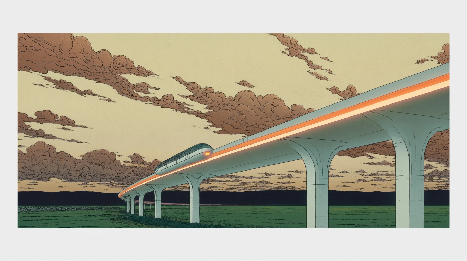
The MELA network runs on elevated guideways supported by slender pylons. The vehicles, called "pods," levitate magnetically above the guideway rails, eliminating friction for smooth, near-silent travel. All energy comes from the Orenda geothermal-solar network: no combustion, no emissions.
The pods are lightweight, aerodynamic capsules seating 4 to 8 passengers. They are driverless, guided by Organic Intelligence (OI, a decentralized, biologically grown computing layer that replaced centralized AI after the Neuralink Collapse) that routes each trip in real time based on demand, other traffic, and energy availability. The pods are public property, maintained by the Transit Cooperative and available to everyone.
To summon a pod, approach any MELA station (there are over 200 throughout the city) and indicate your destination on the interface. The system assigns you to the next available pod heading your way, typically within 2 to 5 minutes. You may ride alone or share with others going the same direction; the system balances both.
Pods travel at 40 to 80 km/h depending on route and conditions: fast enough for practical cross-city trips, slow enough to minimize energy use and noise. The guideways route around sensitive ecological areas, crossing the escarpment through tunnels and bridging waterways at heights that leave room for wildlife below.
The guideways are living infrastructure. Colonies of Lux navigator a bioluminescent lichen from Hamilton's guided evolution programs, grow along the rails and support structures. They provide ambient wayfinding illumination, reducing the need for electric lighting, and create the distinctive warm glow visible across the city at night.

The Mycelium Stain
The mycelium stain on Nia’s hands fades by morning, but never completely disappears. It has been there for years, a subtle darkening of the skin around her fingernails, a faint ochre tint to her palms that no amount of scrubbing removes. She has stopped trying.
“People ask about it sometimes,” she says. “At the market, when I’m selling vegetables. At assembly meetings, when I raise my hand. They look at my hands and they know: this person works with living things. This person touches what grows.”
The stain is a badge, but it is also a reminder. Every morning, when she sees it in the mirror while brushing her teeth, she remembers Rosa’s words: “The system is hungry. It will eat what you’re trying to protect unless you keep feeding it something it doesn’t want.”
What Nia feeds the system is her stubbornness. Her refusal to optimize beyond what living cultures can sustain. Her insistence that rest cycles are not inefficiency but wisdom.
Her mother Ana sent dried mushroom tea again this week, the old kind, wild-foraged from the woods behind her father Ed’s workshop, still labelled in her sister Sandra’s handwriting because Sandra was the one who packaged it. Nia drinks a cup every morning before she starts. She tells herself it is ritual. It is also memory: her sisters Ale and Lucy arguing over which mushroom was which, her father correcting them both, the smell of the kitchen at the house where she grew up. The stain on her hands came later, from her own work, but it rhymes with that older staining, the dirt under her father’s fingernails, the wild-mushroom colour her mother wore like a uniform.
Her cat Luna sleeps on the spore cultures when Nia isn’t looking. Nia has given up trying to keep her out of the lab.
“The stain reminds me that I’m not separate from what I work with,” Nia says. “I carry the mycelium with me. It carries me. We’re in this together, the fungus, the city, the future we’re trying to grow.”
MELA runs as two tiers. Heavy MELA the elevated guideways built over former GO Transit and LRT corridors, carries the high-capacity lines: large pods, major stations, intercity connections. But the system that changed daily life for most Hamiltonians is Light MELA a network of small OI-guided pods hovering on low-energy magnetic cushions just above the road surface.
Light MELA exists because Hamilton has always had road problems. Freeze-thaw cycles on the escarpment, aging infrastructure, constant reconstruction. In the early 2040s, researchers at McMaster University and Mohawk College developed a composite road surface, colloquially called smart asphalt that integrates magnetic guidance strips and distributed OI sensing directly into the pavement. When the city reconstructed a road, it laid smart asphalt instead of conventional material. The extra cost was marginal. The result was transformative.
By 2060, every major road reconstruction in the Hamilton Basin had embedded Light MELA guidance. The pods are small, one or two passengers, and the stations are nothing more than sheltered platforms where bus stops used to be. No heavy base stations. No elevated guideways. Just a magnetically responsive road surface and an OI network that knows where every pod, pedestrian, and cyclist is at all times. Light MELA replaced the bus system not through a single decision but through a thousand incremental road repairs, each one quietly embedding the future into the asphalt.

I take the Light MELA to the food commons most mornings. There is no schedule to learn. I walk to the platform, it is just a shelter on the street, where the bus stop used to be, and a pod arrives within two minutes. It knows where I am going because I go there every day. Sometimes it routes me through the Escarpment Branch instead of the direct line, because the OI has detected a flock of migrating warblers crossing at King and Wellington. I do not mind the detour. The pod slows, and I watch the birds through the canopy. That is my commute. That is what transit feels like when the system pays attention.
It is worth saying plainly what MELA is as a machine, because the name describes a hybrid that has no clean 20th-century analogue. A MELA vehicle is a hybrid maglev/pod: a capsule that can levitate over specially treated pavement at low speed, couple with other capsules into a faster train along dedicated lines, and step up onto the elevated coast-rail at the multilevel Sector NM hub without changing vehicles. Four mechanics make that possible.
1. Asphalt that holds the pod up. Street surfaces in Hamilton were modified during the 2050s and 2060s rebuild with ferromagnetic aggregate and embedded induction coils, the composite the engineers called smart asphalt. A Light MELA pod levitates a few centimetres above this surface at low speed, so everyday streets, the same streets the old buses used, can carry the new vehicle without a dedicated guideway.
2. Pod-connect mode. On dedicated lines, individual pods physically couple nose-to-tail, sharing power draw and reducing aerodynamic drag. A coupled train moves faster than any single pod, and it uncouples automatically when passengers sort onto different destinations. The system behaves like a shoal: individual when the route is thin, collective when the route is full.
3. Coast-rail integration. A pod train can transition onto the high-altitude maglev line that leaves the multilevel Sector NM hub, where the coast-rail takes over and speeds climb further. Because the hub is multilevel, this transition happens inside the same building: you do not transfer, your vehicle does.
4. Bus-route inheritance. MELA did not redraw the map. It moved into the map the buses had already drawn. The same streets, the same stop spacings, the same rights-of-way that the Hamilton Street Railway and its bus successors had worn into the city for a century. What changed was the vehicle, the surface beneath it, and the fact that it no longer burned anything. A redefined system running on an inherited grid.
2.3.2 Using the MELA Network
Access: MELA is free. No fares, no tickets, no turnstiles. The system is funded through the Orenda Commons Levy, a 1.2% allocation on all resource flows tracked by the Orenda Network. In 2091, the Levy generated the equivalent of CAD $2.3 billion (2026 terms), of which 34% went to MELA operations and infrastructure. Walk up and ride.
Stations: MELA stations are designed as public spaces, not mere waiting areas. They include seating, shelter from weather, real-time information displays, and connections to the mesh network. Many stations are integrated with neighborhood centers, food hubs, or fabrication commons, making them natural gathering points.
Boarding: When your assigned pod arrives, the door will open automatically. Enter and take any available seat. If you are sharing the pod with other passengers, the system will display your destination so you know when to expect stops. There is no need to signal or press buttons; the pod knows where everyone is going.
During the ride: The pods are quiet. Conversation is welcome; loud noise is not. You may use the mesh network, read, look out the windows, or sit in silence. Large windows offer views of the city and its ecosystems, so you stay aware of the territory you're moving through.
Accessibility: All pods are designed for universal access. They have low floors and wide doors for easy entry. Priority seating is available for elders, people with disabilities, and those with young children. If you have specific accessibility needs, you can indicate them when summoning a pod, and the system will assign you to an appropriately equipped vehicle.
Bicycles and cargo: Each pod has space for bicycles and small cargo. Larger items can be transported through the Orenda Network (see Section 2.5). If you are traveling with something that won’t fit in a pod, contact your neighborhood assembly for assistance.
2.3.3 MELA Routes and Coverage
The MELA network, as of 2092, consists of eleven lines with forty-three modes (stations). The network radiates from Confederation Central (Mode 0) in Sector NM, but all original stations remain operational.
The 10-module grid. MELA is organised into ten core modules, or routes, arranged as a directional weave across the city: four primary east-west lines running left to right along the Basin’s grain, and six secondary north-south lines running up and down to stitch them together. Four by six. The east-west lines carry the bulk of the system’s long-distance capacity; the north-south lines handle the cross-connections between the escarpment and the harbour, and between the Mountain and the lower city. Together they make a grid that covers the Hamilton Basin at roughly equal density, so no resident is more than a short walk from a module.
The four primary core lines. Four of the ten modules are flagged as the system’s flagship routes, the ones most riders can name:
- Sector NM Line, the harbour-to-inland spine leaving the multilevel Sector NM hub and running the escarpment shoulder. This is the high-altitude maglev route, the one that rides the carved channel, and the line most associated with the word MELA in everyday speech.
- Escarpment Line, the east-west route that follows the escarpment brow, connecting the escarpment shoulder outward to the Agricultural Belt and beyond. Slower than the Sector NM spine, but scenic, and the route that ties the upper city to the rural basin.
- Limeridge Cross-Mountain Line, the east-west route across the Mountain itself. It connects Stoney Creek in the east through Limeridge Mall and the Rymal/Upper James corridor to Ancaster in the west, threading the entire upper-city population band on one line. The former bus-route spine of the Mountain is now this.
- Ancaster–Airport Spur, the international-connection route. Ancaster west to John C. Munro International Airport, and continuing east into Stoney Creek via the Mountain corridor. This is the line visitors arrive on.
The six secondary north-south modules, numbered rather than named, cross these four cores at right angles and carry the district-to-district traffic between them. This framing replaces the older shorthand of “two Mountain stations plus an airport loop”: those stops (Limeridge, Rymal/Upper James, and the airport) are now absorbed as anchor stops on the Limeridge Cross-Mountain Line and the Ancaster–Airport Spur, not as separate Coast Rail branches.
The four core lines and six cross-connectors trace directly back to the 2053 Mera rebuild. When the hub was forced uphill, the planners had a choice between radial and grid. They chose the grid, because a grid is what a basin needs when the high ground has moved.
Primary Hub (Sector NM):
- Mode 0, Confederation Central (primary hub, MELA/GO/Coast Rail interchange)
- Mode 14, Barangas District (Ward 8 connection, vertical farm, seed library, tool lending)
- Mode 15, Industrial Heritage Commons
- Mode 16, MELA Maintenance Yards (converted to public gardens)
West Harbour Branch:
- Mode 1, West Harbour GO
- Mode 2, James Street North (Arts District)
- Mode 3, Bayfront Park
- Mode 4, Pier 4 Restoration Zone
McMaster Branch:
- Mode 5, McMaster University
- Mode 6, University Plaza
- Mode 7, Dundurn Confluence
Eastgate Branch:
- Mode 8, Eastgate Square
- Mode 9, Ottawa Street Corridor
- Mode 10, Barton Textile Commons
Escarpment Branch:
- Mode 11, Escarpment Lookout
- Mode 12, Chedoke Ravine
- Mode 13, Dundas Valley
North Shore Extension:
- Mode 17, Stelco Remediation Zone
- Mode 18, Windmill Point Ecology Center
Cross-City Connectors:
- Mode 19, Main-King Corridor (LRT conversion)
- Mode 20, Cannon Street Arts Walk
- Mode 21, Wilson Street Market District
The network is organized into three tiers:
The Ring Line circles the city at the base of the escarpment, connecting all seven bioregional districts. This is the backbone of the network, with pods arriving every 1–2 minutes during peak times. If you are traveling between districts, you will likely use the Ring Line for at least part of your journey.
The Spoke Lines radiate from the Ring Line into each district, connecting neighborhood centers to the broader network. These lines run every 5–10 minutes during normal hours but provide comprehensive coverage of the urban area.
The Local Lines serve specific neighborhoods with smaller pods and slower speeds, designed to blend into the residential fabric rather than dominate it.
The three-tier network maps onto two physical systems. Ring Line and Spoke Lines run on Heavy MELA: elevated guideways built over former rail corridors. Local Lines run on Light MELA: smart asphalt in reconstructed roads, with bus-stop-scale platforms within a five-minute walk of every resident. A single pod request routes across both, transferring at integration points where guideways meet road-level platforms.
The complete network map is available on the mesh network and posted at all stations. But you do not need to memorize it; the system will route you optimally based on your destination.
Operational Statistics (2092):
- Daily ridership: 340,000 trips
- Average transfer time: 4 minutes
- System availability: 99.4%
- Energy source: 94% on-site generation, 6% regional biogrid
2.3.4 The Experience of MELA
Riding MELA is nothing like early 21st-century transit. No jostling for seats, no fare anxiety, no advertising. The pods are clean, quiet, and comfortable. From the elevated guideways, you look down on green roofs and garden streets, watch the escarpment rise to the south, catch glimpses of the harbor to the north.
Many riders say MELA time has become a valued part of their day: a transitional space between home and work, a pause, a chance for unexpected encounters.
The Signal Butterfly (Papilio notificans) has become part of the MELA experience. During spring and fall migration, flocks drift along the guideway corridors, their wing colors shifting from bright blue in clean air to muted gray when particulate levels rise. Pod speeds drop 15% on overlapping corridors, and the Ring Line's southern arc slows at dusk during autumn passage. Children learn to read the butterflies' colors before they learn to read numbers: bright blue means safe outdoor play.
2.3.5 Ecological Priority Mode
During mass migration events, particularly the autumn Signal Butterfly passage and the spring arrival of migratory songbirds, the Transit Cooperative activates Ecological Priority Mode. Affected guideway corridors switch to deep blue LuxNavigator lighting as a signal to passengers that the system is running under ecological constraints. Pod speeds drop to 25 km/h on affected lines; OI routing shifts remaining traffic to other corridors. The deep blue glow along the southern Ring Line arc during the October butterfly passage has become one of Hamilton's most distinctive seasonal markers: a reminder that the transit system shares its corridors with other travelers.


Hamilton to Toronto. Free for citizens. Geothermal-solar powered with regenerative braking. Continental connections: Montreal (3 hrs), New York (6 hrs), Chicago (8 hrs).
2.4 The Coast Rail
While MELA serves the city, the Coast Rail connects Hamilton to the broader world. This high-speed bioelectric rail network runs along the northern shore of Lake Ontario, linking Hamilton to Toronto in the east and to the regional nodes westward toward the St. Lawrence Seaway.

2.4.1 The Coast Rail Experience
The Coast Rail runs on elevated tracks along the lake shore. Hamilton to Toronto: 45 minutes, with open water and escarpment views the whole way. The trains run on the same geothermal-solar system that powers the city, with regenerative braking on downhill stretches. Interiors are spacious: large windows, workspaces, dining cars, quiet cars.
Unlike MELA, the Coast Rail operates on a schedule. Trains depart every 30 minutes during peak times, every hour during off-peak. You can reserve a seat in advance through the mesh network, though walk-on passengers are always accommodated if space allows.
2.4.2 Using the Coast Rail
Stations and Access: Coast Rail has three primary stations in the Hamilton region. The Mountain stops and the airport are no longer direct Coast Rail branches; they are reached via the MELA Limeridge Cross-Mountain Line and the Ancaster–Airport Spur, which interchange with Coast Rail at Confederation GO inside the multilevel hub.
- Confederation GO (Sector NM), Primary interchange, located at Level +1 of the multilevel Confederation complex. All MELA-to-Coast-Rail transfers pass through here, including Mountain and airport riders arriving on the Limeridge Cross-Mountain Line or the Ancaster–Airport Spur.
- West Harbour GO, Secondary waterfront station (preserved from earlier era)
- Dundas Station, North corridor connection
If 2092 Hamilton scaled from its current 2-million population toward 5 million, intersection-level demand modelling would put new stations at high-density transfer nodes, Mohawk College, Eastgate Square, the Red Hill / Centennial node, the Stoney Creek waterfront, and the McMaster Innovation Park corridor. The current 2.4 network names today’s anchors. The next eight generations will name the rest.
Ticketing: Like MELA, the Coast Rail is free for all citizens. Visitors from outside the region are asked to contribute through a voluntary donation system, but no one is turned away.
Boarding: Arrive at the station 15 minutes before departure. All trains are wheelchair accessible with integrated bike storage.
Onboard: Find your reserved seat or any available seat. The dining car serves food from the agricultural belt: fresh, local, seasonal. Mesh network access is available throughout the train, though many passengers disconnect and watch the landscape unfold.

“I work the night shift at the harbor aquaculture facility, so I ride the MELA at odd hours. There’s a different quality to the city at night. The pods are quieter, the views are darker, the whole experience is more meditative. I’ve come to know the other night riders, the nurse heading to the hospital, the baker going to start the morning bread, the security guard finishing her shift. We don’t always talk, but there’s a recognition, a nod, an acknowledgment that we’re sharing something. The city never sleeps, and neither does its transit. There’s comfort in that.”
Connections: At the Toronto terminus, you can connect to the broader continental rail network, reaching Montreal in three hours, New York in six, Chicago in eight. The Coast Rail is Hamilton’s link to the world, making the city both locally rooted and globally connected.
2.4.3 The Regional Network
Beyond the main Hamilton-Toronto line, the Coast Rail extends westward to the regional nodes: the agricultural communities of the Niagara Peninsula, the industrial cooperatives of St. Catharines, the research stations of the Bruce Peninsula. These regional lines run 4 to 6 times per day, providing essential connectivity for trade, visiting, and regional governance.
The regional network is particularly important for the agricultural belt, allowing fresh produce to reach city markets within hours of harvest and enabling farmers to access city services without long drives. It also supports the regional stewardship councils that coordinate ecological management across the bioregion.
Lake Ontario is inland freshwater. Hamilton does not face actual hurricanes. The real threats are: (1) post-tropical storm remnants, Hurricane Hazel (1954) killed 81 people with 285 mm of rain in 48 hours; (2) seiche events, wind-driven water piling at Hamilton’s western end, raising levels 1–2 m within hours; (3) compound events combining storms, elevated lake levels, escarpment saturation, and ice cover loss. The project correctly labels 2041 as “atmospheric convergence” and 2053 as “post-tropical cyclone.”

2.5 The Orenda Network
Beneath the streets of Hamilton 2092 runs a network that most citizens never see but everyone depends upon: the Orenda Network. Named after the Haudenosaunee concept of spiritual power or energy, this system of underground tunnels carries heat, electricity, goods, and data throughout the city.
The Name “Orenda”
I asked the Elder about the name once. Not directly, I would not presume. But I was with Ravy at a site review near the eastern ravine, and the Elder’s Voice was there, walking the path he walks every equinox, checking something I have learned not to ask about too directly.
Ravy had mentioned the Orenda Network in passing, some calibration issue with the thermal sensors, and the Elder stopped walking. He stood still for a long time, looking at the water. Then he said: “They asked permission before they used that word. Not everyone agreed it should be given. But the ones who said yes believed that if you name a system after a living force, the system has to answer to that force. It is not a brand. It is a responsibility.”
I think about that every time I file a maintenance report on the Orenda system. Every time I type the word into a form. It is not a brand. It is a responsibility. I am not sure the engineers who built it understood that fully. I am not sure I do either. But the Elder’s words sit in me like a seed that has not yet decided what kind of plant it wants to become.
2.5.1 Energy Distribution
The primary function of the Orenda Network is to distribute the geothermal energy that powers the city. Deep beneath the escarpment, wells tap into the earth’s heat, bringing up water at temperatures hot enough to generate electricity and warm enough to heat buildings. This energy is distributed through insulated pipes that run through the Orenda tunnels, reaching every building in the city.
The network is remarkably efficient. Geothermal energy is constant, unlike solar or wind, providing baseload power regardless of weather or time of day. The distribution system minimizes heat loss through advanced insulation and smart routing. And the entire system is monitored by OI that optimizes energy flows based on demand, weather forecasts, and building occupancy.
As a citizen, you do not need to manage your connection to the Orenda Network. Your building is automatically supplied with heat and electricity, metered and balanced through the mesh network. You can monitor your usage and adjust your consumption, but the system is designed to be seamless and reliable.
2.5.2 Goods Movement
The Orenda Network also includes an automated freight system that moves goods throughout the city. This underground logistics network carries everything from fresh produce to fabrication materials to recycled waste, keeping heavy trucks off the streets and reducing surface congestion.
The freight capsules are autonomous, electric, and designed for the specific goods they carry. Produce travels in climate-controlled containers that maintain freshness. Fabrication materials move in standardized totes that can be loaded directly into workshop equipment. Waste streams are separated at source and routed to appropriate processing facilities.
For citizens, the Orenda freight system means that you can order goods from anywhere in the city and have them delivered to your neighborhood center within hours. It means that the streets are free of delivery trucks, making them safer and more pleasant for walking and cycling. It means that the material metabolism of the city happens largely out of sight, but efficiently and sustainably.
2.5.3 Data Infrastructure
The Orenda tunnels carry the mesh network’s fiber optic backbone, providing the communications infrastructure that connects every home, workplace, and civic space in the city. This underground placement protects the cables from weather and damage while allowing for easy maintenance and upgrades.
The mesh network nodes are distributed throughout the Orenda system, with redundant pathways ensuring that no single point of failure can disrupt communications. This resilience was tested during the ice storm of 2087, when surface power was disrupted but the mesh network remained operational, allowing citizens to coordinate response and mutual aid.
2.5.4 Maintenance
Maintenance of the Orenda Network is shared between the Transit Cooperative, the Energy Commons, and the specialized mycoremediation teams who monitor the tunnel ecosystem. The tunnels themselves host colonies of LuxNavigator lichen that provide emergency wayfinding illumination and serve as bioindicators of tunnel air quality.
The Orenda Stewards are a respected community within Hamilton, with their own traditions, training programs, and culture. They work in shifts around the clock, monitoring the systems, performing maintenance, responding to emergencies. Their work requires specialized knowledge of geothermal engineering, logistics automation, network infrastructure, and the complex interactions between these systems.

If you are interested in becoming an Orenda Steward, training is available through the Technical Education Collective. It is demanding work: tending the hidden veins and arteries of the city, keeping energy, data, and goods flowing without interruption. Most Stewards describe it as one of the most satisfying roles in Hamilton.

2.6 Walking and Cycling
Most daily trips in Hamilton 2092 are made on foot or by bicycle. MELA, the Coast Rail, and the Orenda Network are the backbone, but neighborhoods are designed so that most of what you need is within a fifteen-minute walk.
2.6.1 The Pedestrian City
The streets are designed for walking first: wide sidewalks, shade trees, rest areas every few blocks, and surfaces that stay cool through evaporative cooling from soil and plants. Walking here is slow on purpose. The pace lets you notice things: gardens in progress, a neighbour's conversation, a hawk perched on a guideway pylon. Most residents say their daily walks are as important to their well-being as sleep.
The city maintains an extensive network of walking paths that go beyond the streets:
Ravine trails: The creek systems wind through the city, offering routes that feel almost rural despite being in the urban core. Red Hill Creek, Chedoke Creek, and the dozens of restored waterways provide shaded, peaceful corridors for walking.
The ravine trails along Red Hill Creek feel nothing like transit. They feel like the city has quietly agreed to leave this corridor to whoever wants it: children on bikes, elders with poles, the occasional coyote at dusk. And yet they connect three neighborhoods more efficiently than any road does.
Escarpment stairs: Repurposed from the old industrial access routes, these vertical connections between the lower and upper city offer spectacular views as reward for the climb. The stairs are maintained by neighborhood stewardship groups, with rest platforms, handrails, and emergency call stations at regular intervals.

Waterfront promenade: Running the length of the harbor, this is a favorite route for evening strolls, morning runs, and weekend family outings. The promenade connects the Coast Rail terminus to Cootes Paradise, passing through the remediation wetlands and aquaculture facilities along the way.
The streets of the Lower City are predominantly pedestrian and cycling spaces. Car lanes have been narrowed, repurposed, or removed. The result is a streetscape built for human movement: wide sidewalks, protected cycling infrastructure, and public spaces that invite lingering.
2.6.2 Cycling Infrastructure
For trips too long to walk comfortably, cycling is the preferred mode. Hamilton 2092 has an extensive network of bike lanes, separated paths, and bike-friendly streets that make cycling safe and convenient for all ages and abilities.
The cycling network is designed with several principles in mind:
Separation: Cyclists are separated from vehicles wherever possible by physical barriers: planters, bollards, or grade separation. This removes the conflicts that once made cycling feel dangerous.
Continuity: The network is comprehensive, with routes connecting all neighborhoods and major destinations. You can cycle from any point in the city to any other point without encountering dangerous gaps.
Comfort: Routes are designed for comfort as well as safety, with smooth surfaces, gentle grades, shade trees, and scenic views. Cycling should be pleasant, not merely possible.
Integration: Bike parking is abundant at all major destinations: neighborhood centers, transit stations, fabrication commons, cultural venues. MELA pods carry bicycles, making multi-modal trips easy.
The city provides bicycles free of charge to all citizens who want them. These are sturdy, low-maintenance bikes designed for urban utility rather than speed or sport. They can be picked up at any neighborhood center, maintained at the fabrication commons, and returned when no longer needed.
2.6.3 The Culture of Slow Movement
Hamilton favors slow movement, though no one enforces it. MELA is fast when you need it. But there is a general understanding that how you get somewhere matters as much as getting there. This shows up in a few ways:
The stroll: Walking slowly, pausing, chatting with neighbors is normal. Rushing is seen as slightly suspicious. Why the hurry? What did you fail to plan for?
The cycle cruise: Cyclists often travel at conversational speeds, riding side by side, talking as they go. The separated infrastructure makes this possible, allowing social cycling without blocking faster traffic.
Transit as social space: The MELA pods and Coast Rail trains are designed for comfort and conversation, not just efficiency. It is normal to strike up conversations with fellow passengers, to share observations about the city, to build the weak ties that bind community together.
This is a deliberate choice, backed by infrastructure and held in place by social habit. It reduces stress, builds casual connection, and keeps people paying attention to where they live.

2.7 Ecological Integration
The transit systems are built into the landscape, not imposed on it. Route planning, vehicle design, and maintenance all start with the same question: what does this place need?
2.7.1 Wildlife Corridors and Transit
The most visible form of ecological integration is the protection of wildlife corridors. Hamilton's urban area is crossed by routes animals have used for centuries: along creek valleys, across the escarpment, between habitat patches. These corridors are essential for biodiversity, letting populations mix, migrate, and adapt.
The MELA guideways are designed to bridge these corridors at heights that allow unimpeded wildlife passage beneath. Tunnels through the escarpment are fitted with wildlife underpasses. The Ring Line’s routing was adjusted three times during construction to avoid disrupting known migration paths.
Elevated guideways: The MELA system runs above ground level, allowing animals to pass beneath. The pylons are spaced to maintain connectivity, and the guideways are designed to be permeable to small animals and birds.
Tunneling through sensitive areas: Where the network must cross sensitive habitat (the escarpment face, major creek systems), it goes underground. The tunnels include wildlife passages that maintain connectivity below ground.
Seasonal restrictions: Some routes have seasonal restrictions to protect wildlife during sensitive periods. During the spring bird migration, certain MELA lines run at reduced speeds to minimize collision risk. During salmon spawning season, construction and maintenance activities near creek crossings are prohibited.
Crossing structures: Where roads and paths cross wildlife corridors, crossing structures (underpasses, overpasses, amphibian tunnels) let animals move safely. Wildlife cameras monitor these and the Stewardship Council maintains them.

The result is a transit network that animals can live with. Coyotes move through the city at night, using the same corridors they have used for millennia. Deer cross from the escarpment to the lower city via the tunnel under the rail line. Frogs migrate to breeding ponds through tunnels designed for their use. The city is a shared space, and the transit system acknowledges this sharing.
2.7.2 Habitat Integration in Infrastructure
Beyond avoiding harm, the transit infrastructure actively creates habitat:
Green guideways: The MELA pylons and the spaces beneath the elevated guideways are planted with native vegetation, creating linear habitat corridors that connect larger green spaces. These plantings are maintained by neighborhood stewardship groups and provide food and shelter for insects, birds, and small mammals.
Living stations: MELA stations incorporate green roofs, living walls, and habitat features. Swifts nest in the tower at the Harbor Terminus. Peregrine falcons hunt from the ledges of the Lower City Station. Filter Finches ( Spinus filtrans) line the air-filtration housings, and SensorMoss ( Bryum sensorium) carpets the interior walls, feeding live environmental data into the city layer. The stations function as vertical ecosystems.

Pollinator pathways: The cycling and walking networks are planted with pollinator-friendly species, creating corridors that allow bees, butterflies, and other pollinators to move through the city.
Dark sky compliance: The transit system uses minimal lighting, and what lighting is used is designed to minimize disruption to nocturnal animals. Full cutoff fixtures direct light downward, reducing sky glow.
2.7.3 Energy and Emissions
All transit is powered by the Orenda geothermal-solar network, with no fossil fuel combustion. Regenerative braking captures energy during deceleration. Lightweight design minimizes energy required for acceleration. Demand-responsive operation avoids the waste of empty vehicles running on fixed schedules.
The result is a transit system that moves hundreds of thousands of people daily with a fraction of the energy and none of the emissions of the automobile-dependent cities of the past.
2.7.4 The Signal Butterfly and MELA Scheduling
Signal Butterfly (Papilio notificans) migration is now formally built into MELA operations. Twice a year, spring northward passage and autumn return, the Transit Cooperative activates the Migration Protocol, reducing pod speeds on affected corridors. The butterflies' bioluminescent wing patterns do double work: air quality indicators visible to residents below the guideways, and informal markers of the turning season. When Signal Butterflies appear along the Ring Line, Hamilton knows.
Watching the Ring Line slow for the butterfly passage is one of those moments when the system shows its values without saying anything. The pods glide at walking pace, the guideway turns deep blue, and a wave of orange-and-black moves through the corridor below. Nobody objects to the delay.


2.8 Transit and Social Life
Transit in Hamilton 2092 creates conditions for social life as much as it moves people. Stations, pods, and routes are all designed to encourage the casual, repeated encounters that hold a city together.
2.8.1 Stations as Public Space
MELA stations serve as neighborhood gathering points. They are designed as destinations in themselves, not just points of departure and arrival:
Gathering spaces: Covered areas with seating where people can wait comfortably, meet friends, or simply rest.
Food and drink: Many stations have kiosks selling fresh food from the agricultural belt, allowing passengers to grab a meal or snack.
Information: Real-time displays of transit information, mesh network access points, and notice boards for community announcements.
Art and culture: Stations feature rotating exhibitions of local art, performances by musicians, and other cultural programming.
Green space: Stations are surrounded by plantings, creating pocket parks that serve the neighborhood even for those not using transit.
The integration with food hubs, fabrication commons, and neighborhood centers means that stations are places where people linger, not just pass through.
At Eastgate Station on a Tuesday afternoon, I counted eleven conversations between strangers in under twenty minutes. Two were about the garden beds on the station platform. One was a child asking an elder how the pod "knows where to go." She thought about it for a moment and said: "It pays attention."
2.8.2 The Social Dynamics of Shared Rides
The MELA pod system often matches passengers traveling similar routes, creating shared rides with strangers. This is not an unfortunate necessity but a deliberate design choice, creating opportunities for social encounter.
The pods are designed for comfortable interaction: facing seats, good lighting, quiet operation. Silence is fine; so is conversation. The conditions support both.
Many riders say some of their most interesting conversations have happened in MELA pods, with people they would never have met otherwise. The random matching brings together different ages, different neighborhoods, different backgrounds, connected by the chance of shared destination.

2.8.3 Transit as Civic Ritual
The daily commute on MELA or the Coast Rail has become a kind of civic ritual, a shared experience that quietly binds citizens together. Moving through the city at the same hours, in the same pods, builds a subtle sense of connection over time.
This ritual quality is enhanced by the seasonal variations in transit experience. The spring commute, when the gardens are blooming and the migratory birds are passing through. The winter commute, when the city is transformed by snow and the pods are warm refuges from the cold. The shared experience of these variations creates a kind of collective calendar, a rhythm that synchronizes the lives of thousands of people.

Pods are sensory-adapted. 1,200 Elder Co-Routing trips daily. Zero platform gaps (auto-levelling floors). Multilingual signage in six languages plus Anishinaabemowin.
2.9 Accessibility and Universal Design
A transit system that excludes people is not a public good. Every part of Hamilton's transit is designed so that everyone can use it.
2.9.1 Physical Accessibility
All aspects of the transit system are designed for people with disabilities:
MELA pods: Low floors and wide doors allow easy boarding for wheelchair users. Priority seating is clearly marked and respected. Visual and audio announcements inform passengers of stops. The mesh network interface is compatible with screen readers and other assistive technologies.
Stations: Elevators and ramps provide access to elevated platforms. Tactile paving guides visually impaired passengers. Clear signage with high contrast and large text aids those with low vision. Hearing loops assist those with hearing aids.
Coast Rail: All trains have accessible cars with spaces for wheelchairs and mobility scooters. Stations are fully accessible, with staff available to assist as needed.
Walking and cycling: The pedestrian network includes curb cuts, audible signals at crossings, and rest areas for those who need to pause. Adaptive bicycles are available for those who cannot use standard bikes.
The Accessibility Cooperative, composed of people with disabilities, reviews all transit designs and operations, ensuring that accessibility is not an afterthought but a fundamental requirement.
Sensory-Adapted Pods: One in four pods on any MELA line is designated a sensory-adapted pod: lower ambient lighting, reduced audio announcements (visual-only displays), sound-dampening panels, and slower acceleration/deceleration profiles.

Neurodivergent Wayfinding: MELA stations use a dual-layer wayfinding system: standard visual signage plus a tactile/auditory system for low-vision and blind users, and an Orenda Coil routing mode that provides step-by-step audio guidance.
Elder Co-Routing: Any resident over 75 (or any resident with a registered mobility care profile) can activate the Co-Routing protocol via their Orenda Coil. The system books the optimal pod route and dispatches a volunteer Grove steward to accompany the resident from door to pod to destination. Co-Routing is used approximately 1,200 times per day.
Mobility Assist Nodes: Every MELA station has a Mobility Assist Node: a staffed or Orenda-monitored bay with power wheelchair charging, transfer assists, and emergency communication. Platform gaps between pod doors and station edge are eliminated by auto-levelling pod floors.
2.9.2 Economic Accessibility
All transit in Hamilton 2092 is free. No fares, no passes, no financial barriers. Mobility is a right, not something you buy.
This policy is funded through the city’s general budget and the Orenda Commons Levy, supported by the economic productivity that transit enables. It is understood as an investment in the city’s social and economic functioning, not a cost to be minimized.
2.9.3 Cultural Accessibility
Transit is designed to be welcoming to all cultures and languages:
Multilingual information: All announcements and signage are provided in the major languages spoken in Hamilton, including English, French, Spanish, Arabic, Mandarin, and Anishinaabemowin.
Cultural sensitivity: Staff are trained in cultural competency, able to assist passengers from diverse backgrounds with respect and understanding.
Religious accommodation: The system accommodates religious needs, such as prayer spaces at major stations and scheduling that respects religious observances.
2.9.4 Safety and Comfort
Transit is designed to be safe and comfortable for all users, including those who might feel vulnerable in public space:
Lighting: All stations and vehicles are well-lit, creating a sense of safety and visibility.
Emergency systems: Emergency call buttons connect directly to transit security, who are trained in de-escalation and trauma-informed response.
Active bystander culture: Citizens are encouraged to look out for each other, to intervene if they see harassment or distress, to create a culture of collective care.
Night service: The MELA system operates 24 hours, ensuring that those who need to travel at night can do so safely.
Pod service interval. Guideways inspected continuously by automated systems. LuxNavigator colonies monitored seasonally. Pods fabricated in Sector NM, designed for disassembly and reuse.
2.10 Maintenance and Evolution
The transit systems are always changing: maintained, upgraded, and adjusted as the city evolves.
2.10.1 The Transit Cooperative
The transit systems are operated by the Transit Cooperative, a worker-owned cooperative that employs several thousand Hamiltonians. The Cooperative is governed democratically, with major decisions made by the membership and day-to-day operations managed by elected councils.
The Cooperative includes several divisions:
Operations: The staff who monitor the systems, respond to disruptions, and ensure smooth functioning.
Maintenance: The technicians who keep the vehicles, guideways, and stations in working order.
Planning: The engineers and designers who plan expansions, upgrades, and modifications.
Community Relations: The outreach workers who engage with neighborhoods, gather feedback, and ensure that the system serves community needs.
Membership in the Cooperative is open to anyone who completes the training program and commits to the cooperative’s principles. Members receive a living wage, benefits, and a voice in the governance of their workplace.
2.10.2 Maintenance Practices
The transit infrastructure is maintained through a combination of preventive and responsive practices:
Preventive maintenance: Regular inspections and servicing prevent problems before they occur. The MELA pods are serviced every 10,000 kilometers. The guideways are inspected continuously by automated systems and regularly by human technicians. The stations are cleaned and maintained daily.
Responsive maintenance: When problems do occur, the Cooperative responds quickly. The mesh network allows citizens to report issues directly, and maintenance crews are dispatched promptly. The goal is to minimize disruption and maintain reliability.
Continuous improvement: Maintenance doubles as an opportunity for improvement. Technicians are encouraged to identify design flaws and suggest modifications. The system evolves through thousands of small improvements made by the people who know it best.
The LuxNavigator lichen colonies require seasonal monitoring: their bioluminescent output fluctuates with temperature and humidity, and cultivation teams (including Nia Crosby's Dundas Valley station) propagate replacement cultures when colonies thin. Pods are fabricated in Sector NM's open-source workshops, designed for disassembly and component reuse.
Light MELA expansion follows the road reconstruction cycle. When a road reaches the end of its service life (typically every 20 to 30 years), the Transit Cooperative coordinates with Public Works to lay smart asphalt during reconstruction. The embedded guidance strips and OI sensors are manufactured locally at the Mohawk College Advanced Materials Lab, using recycled steel from the former Stelco operations. The cost differential between smart asphalt and conventional road surface has dropped below 8% since 2065, making Light MELA deployment a default rather than a decision. By 2092, fewer than forty road-kilometres in the entire Basin remain unconverted.

The best thing about smart asphalt is that you cannot see it. The road looks like a road. But under the surface, there are guidance strips made from recycled Stelco steel and OI sensors grown on mycelial substrates at Mohawk’s materials lab. When they repaved Concession Street last year, the construction crew laid Light MELA guidance in three days. No new stations. No elevated structure. Just a road that now knows how to carry pods. My neighbour did not even realize the street had been converted until she saw a pod glide past her window at breakfast. “When did that happen?” she asked. That is how infrastructure should work. Quiet. Incremental. Already there before you notice.
2.10.3 Planning and Expansion
The transit network is constantly evolving to meet changing needs:
Neighborhood input: When new housing is built or neighborhood patterns change, the Cooperative works with neighborhood assemblies to assess transit needs and plan adjustments.
Environmental monitoring: The ecological impacts of the transit network are continuously monitored, and routes are modified to protect sensitive habitats or improve connectivity.
Technological upgrades: As technology improves, the system is upgraded. New pod designs with better efficiency or comfort are introduced. The control systems are updated with better algorithms. The stations are retrofitted with improved accessibility features.
Regional coordination: The Cooperative coordinates with regional transit authorities to ensure seamless connections and integrated planning.
2.10.4 Emergency Response
The transit system is designed to function during emergencies and to support emergency response:
Redundancy: Multiple routes and backup systems ensure that the network can continue operating even if parts are disrupted.
Emergency protocols: Clear protocols cover all major emergency types: severe weather, power outages, accidents, security incidents. Staff train and practice regularly.
Mutual aid: The transit system supports broader mutual aid efforts during emergencies, providing transportation for evacuations, delivering supplies, and facilitating communication.

2.11 The Future of Transit
Using transit in Hamilton 2092 means joining an experiment still in progress. The city is still learning what works.
2.11.1 Ongoing Challenges
Despite its successes, the transit system faces ongoing challenges:
Capacity: As the city grows and evolves, some routes experience crowding during peak times. The Cooperative is exploring solutions, including higher-capacity vehicles and demand management strategies.
Accessibility gaps: The system is designed for universal access, but gaps remain: older stations needing retrofitting, routes still difficult for some users, information systems that could be more inclusive. The Accessibility Cooperative works continuously to identify and close them.
Ecological impacts: Even the best-designed transit system has ecological impacts. The construction of new guideways disrupts habitat. The energy consumption, while minimal, is not zero. The Cooperative works continuously to minimize these impacts and to offset what cannot be eliminated.
Regional integration: Coordination with transit systems beyond Hamilton’s borders remains challenging. The Coast Rail connects to regional networks, but seamless integration is still a work in progress.
2.11.2 Emerging Possibilities
New technologies and approaches offer possibilities for the future:
Autonomous evolution: The OI systems that animate the MELA network are continuously learning and growing. Future generations of the system may be able to predict demand more accurately, optimize energy use more precisely, and respond to disruptions more gracefully.
Active transport expansion: The walking and cycling networks continue to expand, with new routes, better infrastructure, and innovative designs that make active transport even more attractive.
Fabrication integration: The Orenda freight system may be expanded to support new forms of distributed manufacturing, with fabrication happening closer to where products are used.
Climate adaptation: As the climate continues to change, the transit system will need to adapt. The Cooperative is planning for more extreme weather, higher temperatures, and changing patterns of movement.
2.11.3 The Longer Horizon: 2292
What might MELA become in another two hundred years? The guideways may become living structures, grown rather than built. The pods may become organic in form, barely distinguishable from the landscape. The boundary between transit infrastructure and ecosystem may dissolve entirely. This is not a plan but a possibility, a seed planted in the system's architecture for future generations to cultivate.
The MELA system you ride today was designed by people who thought in generations, not product cycles. Among the earliest conceptual work was a project by Alejandro Hernandez Guzman, a design student at Sheridan College in 2026, whose thesis explored how transit could become a living system. His prototype, the Multi-Lens was not a transit device but a way of seeing the city's hidden systems: a tool for revealing connections that would otherwise remain invisible. The design philosophy it embodied, "reveal connections, don't add noise," became foundational to MELA's development.

Today’s MELA pods carry four to eight passengers along fixed guideways. But the system’s architects always imagined more. The pod chassis is modular by design. The OI that coordinates routing learns continuously with each journey, each disruption, each seasonal shift. The mycelium integration in the guideways was chosen not just for structural reasons but because biological systems adapt in ways that engineered systems cannot, because they grow and heal and respond to changing conditions.
Some transit planners speak quietly about what MELA might become across two more centuries. Pods that reshape themselves for each passenger, their interiors and comfort reconfiguring in response to need. Guideways that grow and retract with demand, expanding where the city needs them and contracting where they are no longer essential. An intelligence so distributed it becomes indistinguishable from the city’s own metabolism, so responsive that the system and the citizens it serves are in constant conversation.
These are not plans. They are possibilities, seeds planted in the system's architecture now, waiting for future generations to cultivate and imagine.
For a speculative vision of what MELA might look like in the year 2292, see Chapter 8.
2.11.4 Your Role
The future of transit in Hamilton depends on you. Your feedback, your participation, your ideas all shape how the system evolves.
If you see a problem, report it through the mesh network. If you have an idea for improvement, bring it to your neighborhood assembly or the Transit Cooperative. If you are interested in working on transit, consider joining the Cooperative or volunteering with community transit initiatives.
The transit system is a commons, owned and operated by the people of Hamilton. It serves you, and it depends on you. Together, we keep the city moving.
Every MELA line, every mycelial printer, every spore culture is a political choice.
“My hands, stained with fungal ink, are the visual metaphor for human participation in non-human governance. I work inside MELA, use Orenda sensors, submit compliance reports. I’m part of the system. And yet I question it constantly. I worry that efficiency will replicate only the good parts of what La Ferme was about, food security, ecological regeneration, and leave behind the radical parts: community autonomy, refusal of growth logic, relationship over extraction.”

Completion year. Guideway at 8 m (vs. standard 12 m) to respect row housing scale. Three stations: Eastgate Square, Ottawa Street, Barton Textile Commons. LuxNavigator at 60% intensity, still growing.
2.12 Sector NM Eastern Gateway: Addendum
The Eastern Gateway, the approach to Sector NM from the Eastgate and Ottawa Street corridors, was the last major MELA expansion, completed in 2088. The route follows the former industrial rail corridor through Crown Point and Gibson, neighborhoods among the first to benefit from the brownfield remediation. The guideway here runs lower than elsewhere in the network, approximately 8 metres rather than the standard 12, to respect the scale of the surrounding row housing.
Three new stations anchor the Eastern Gateway: Mode 8 (Eastgate Square), Mode 9 (Ottawa Street Corridor), and Mode 10 (Barton Textile Commons). The Ottawa Street station incorporates the historic textile mills into its platform design, preserving the industrial memory while repurposing the structures as transit-integrated community space.

LuxNavigator colonies along the Eastern Gateway guideway were planted in 2087 and are still establishing. Their bioluminescent output is currently at approximately 60% of mature colony intensity, giving the eastern approach a subtler, more tentative glow than the older western lines: a visible reminder that the system is still growing.
The Eastern Gateway guideway at dusk: the LuxNavigator colonies are still young, and the bioluminescence is patchy and tentative compared to the western lines. It looks less like finished infrastructure and more like something still deciding what to become.
